End of an era for legacy POES constellation:
NOAA has completed End of Life (EOL) testing activities for NOAA-15 and NOAA-19 and will commence the decommission process shortly.
As a reminder, NOAA-18 was decommissioned on June 6, 2025 at 1740 UTC due to an unrecoverable failure to the S-Band transmitter. The remaining satellites in the legacy POES constellation will be decommissioned as follows: NOAA-15 on August 12, 2025 and NOAA-19 on August 19, 2025.
For more info, please click here
August 1, 2025
Latest BioGeoChemical-Argo Float data Latest Snapshot Archive (12-17-2024) of the BioGeoChemical-Argo Float data from SOCCOM and UW-MBARI is now available on our Data Server. Check out our Data Portal. January 3, 2025
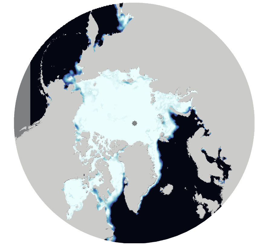
The Version 5 of NOAA/NSIDC Sea Ice Concentration CDR Data Available on PolarWatch ERDDAP The NOAA/NSIDC Sea Ice Climate Data Record (CDR) Version 5 (Daily and Monthly), is now available. To preview and download, click here for Arctic data and here for Antarctic data. January 2, 2025
Dr. Ludovic Brucker (NESDIS STAR), PolarWatch Science Advisor, presented "Highlighting the Value of Sea Ice Products through Distinct Use Cases." Dr. Brucker has shared insights into the value of sea ice products for key stakeholders on Tuesday February 21, 9am Pacific Time.
February 10, 2025
Check out the Code Gallery page for updated and new code examples. You can find code samples and additional tutorials in the CoastWatch Tutorial GitHub repository. October 4, 2024
Dr. Cara Wilson, PolarWatch node manager, will present 'How to access ERDDAP data using R' on June 20, 2024 at the GOOS ERDDAP Seminar Series. Click here to register. June 5, 2024
The CoastWatch (CW) Utilities version 4 is now available. This comprehensive software package features graphical tools for interactive data viewing and command line tools for data processing. For more information about the software and this latest release or to download the software, visit the CW Utilities website. An online tutorial is available on the CoastWatch Learning Portal. May 10, 2024
ERDDAP Server Maintenance [DATE CHANGED] We have scheduled server maintenance for all PolarWatch Servers on May 7 from 6 AM to 10AM Pacific Time. Thank you for your patience and understanding. April 17, 2024
The Blended Sea Ice Concentration from AMSR2/VIIRS Daily data products for both the Arctic and Antarctic regions are currently unavailable until further notice. This suspension is due to the NOAA-20 satellite undergoing a series of propulsive maneuvers as part of an orbit rephasing effort scheduled for April 4th, 2024. For more information, please click here. March 20, 2024
ERDDAP Server Maintenance We have scheduled server maintenance for PolarWatch ERDDAP on March 14th and 15th, from 6 AM to 4 PM Pacific Time. Thank you for your patience and understanding. Mar 13, 2024
The latest version, CF-1.11, of the CF Metadata Conventions has been released and is accessible at https://cfconventions.org/. These conventions are instrumental in establishing standards and best practices for accurately describing data. Dec 7, 2023
Latest BioGeoChemical-Argo Float data
Latest Snapshot Archive (08-28-2023) of the BioGeoChemical-Argo Float data from SOCCOM and UW-MBARI is now available on our Data Server. Check out our Data Portal.
October 4, 2023
High Latitude Underwater Glider data sets are available. Check out the data from our ERDDAP Data Server and learn more about Underwater Gliders. Apr 28, 2023
Planned termination of NOAA NRT MODIS SST products
Due to a degraded performance of Aqua and Terra Moderate Resolution Imaging Spectroradiometer (MODIS), which both currently fly in unstable (not corrected) orbits, NOAA near real-time processing of MODIS sea surface temperature (SST) products will be terminated as of October 1, 2023.
September 28, 2023
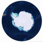
2023 Antarctic sea ice area where the ice cover is at least 15 percent is the lowest on record based on the sea ice data from National Snow and Ice Data Center (NSIDC). Click here for more September 27, 2023
Latest Snapshot Archive of the BioGeoChemical-Argo Float data from SOCCOM and UW-MBARI is now available on our Data Server. Check out our Data Portal. Apr 24, 2023
ERDDAP Update (version 2.22) - Version notes and installation instructions available Dec 30, 2022
ERDDAP Update - ERDDAP version 2.21 was released on 10/09/2022. (Version notes) Dec 30, 2022
ERDDAP Update - ERDDAP version 2.20 was released on 09/30/2022. (Version notes) Dec 30, 2022
ERDDAP Update - ERDDAP version 2.19 was released on 09/01/2022. (Version notes) Dec 30, 2022
All instruments aboard the SNPP spacecraft (including VIIRS) are in safe mode and not transmitting data. and View Outage Announcment Jul 27, 2022
ERDDAP Update - ERDDAP version 2.18 was released on 02/23/2022. (Version notes) Feb 23, 2022
The MODIS Aqua mission will end October 31, 2022 at that time satellite products from the sensor will will no longer be produced. Apr 25, 2022
The CoastWatch Ocean Satellite Data Course was held on 24-28 January 2022. Jan 28, 2022
NSIDC Sea Ice CDR V4 data set updated to include Jan-May 2021. Feb 30, 2022
Archives prior to Feb 2022
These archives follow a different format from a prior website
NOAA CoastWatch Satellite Data Course
Interested in using satellite data but don't know where to start? Learn about environmental satellite data and how to easily obtain it at our next course virtual the week of January 24, 2022. Additional information and registration instructions are available on the CoastWatch West Coast Node website.
EDMW 2021 ERDDAP and NetCDF Training
Join us for a half-day virtual training on ERDDAP and NetCDF data at the NOAA Environmental Data Management Workshop on Monday, Aug 16.
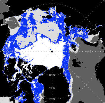
10km AMSR2 Sea Ice Concentration Now Available
AMSR-2 sea ice concentration for the Arctic and Antarctic are now available in the PolarWatch Portal.
750m VIIRS sea ice products now available
750m VIIRS sea ice products for the Arctic and Antarctic are now available in the PolarWatch Portal. Products include sea ice concentration, sea ice thickness and surface temperature.
Contribute to the next Arctic Research Plan
 The Interagency Arctic Research Policy Committee (IARPC) is developing the next Arctic Research Plan for 2022–2026 and is seeking input from any interested individuals and organizations. The comment period is open through June 11, 2021.
ESA CCI Ocean Colour Version 5 Available
Version 5.0 of the ESA CCI Ocean Colour Product is available on the West Coast Node ERDDAP, providing over 60 ocean color products at daily, 8-day, and monthly intervals back to 1997.
Registration Open for May 2021 CoastWatch Course
The next NOAA CoastWatch course will be held online on May 3-7, 2021. Registration is now open. Learn about available environmental satellite data and gain hands on experience accessing data and incorporating it into your projects.
Arctic Report Card: Update for 2020
The sustained transformation to a warmer, less frozen and biologically changed Arctic remains clear
Scripts for converting projected coordinates added
Two new R scripts that demonstrate converting to and from polar projections are now available in the PolarWatch Code Gallery. Thank you to Doug Kinsey and Randy Cutter from NOAA SWFSC for contributing and sharing their code samples. These scripts access satellite and in-situ data from the PolarWatch ERDDAP and demonstrate transforming the coordinates using R spatial dataframes.
OSI-SAF Sea Ice Product Now Available
The EUMETSAT OSI-SAF Sea Ice Concentration product for the Arctic and Antarctic is available in the PolarWatch Portal. Previously we hosted a subset of this dataset, now the full extent of data are available.
Oceans Stakeholder Workshop, November 17 - 20, 2020
Calling all CoastWatch Users! All data product users are encouraged to attend an Oceans Stakeholder Workshop, November 17 - 20, 2020. It is a chance for stakeholders to voice their needs in a high-profile gathering with NESDIS management. Commercial users are invited, along with NOAA users and outside NOAA organizations of all kinds.
New Features added to PolarWatch Catalog
The PolarWatch Catalog has been updated to offer a new list view that makes it easier to compare datasets and provides streamlined access to the data.
Update - ICESAT-2 Hackweek
Applications for a virtual ICESat-2 Hackweek will be accepted until April 10. Virtual tutorials will be provided in May with a 2-3 day hack event the week of June 15, 2020.
Telework begins due to Coronavirus
PolarWatch is transitioning operations to maximum telework due to federal Coronavirus guidance. We anticipate that data systems will remain fully operational and our staff can best be reached via email until further notice. Stay safe.
ICESat-2 Hack Week
Apply now to attend the ICESat-2 Hack Week, June 15-19, 2020, on the University of Washington campus in Seattle. There will be five days focused on open source tools to analyze and visualize ICESat-2 data for cryospheric applications. Applications are welcomed from participants at any career stage and level of technical ability. Application deadline: April 3, 2020. Visit https://icesat-2hackweek.
APP-X Polar Pathfinder Sea Ice Thickness Data Now Available through PolarWatch
The APP-X Polar Pathfinder sea ice thickness and atmospheric data are now available through PolarWatch
Operations Manager Out of Office
The PolarWatch Operations Manager will be out on parental leave through January. Please direct questions about PolarWatch data and website to Dale Robinson (Dale.Robinson@noaa.gov) for all other inquiries please contact Cara Wilson (Cara.Wilson@noaa.gov).
New Sea Ice Pressure Ridge Sail Height Product Available
 A new Sea Ice Pressure Ridge Sail Height product from NOAA is now available in the PolarWatch ERDDAP. Sail height data is derived from high-resolution airborne imagery acquired during NASA's annual Operation IceBridge campaigns in the Arctic (2010-2018). Pressure ridges impact mass, energy, and momentum budgets of sea-ice cover and present an obstacle to transportation through icy waters. Quantifying ridge characteristics is important for understanding total sea-ice mass and for improving sea-ice dynamics in high-resolution models.
Seminar on Arctic Sea Ice Altimetry
On September 11, PolarWatch program scientist, Sinéad Farrell, presented, "Advances in Satellite and Airborne Altimetry over Arctic Sea Ice – Towards Improved Prediction", as part of the NOAA NESDIS STAR seminar series. The seminar abstract and slides are available on the seminar series web page.
New Marine Heatwave Emerges off West Coast, Resembles "the Blob"
Researchers are monitoring a new marine heatwave off the West Coast for effects on the marine ecosystem. The warm expanse building off the West Coast stretches roughly from Alaska south to California
PolarWatch Webinar
Slides are now available from the recent webinar Jennifer Sevadjian presented as part of the NESDIS STAR webinar series. The slides provide an overview of the data and services provided by PolarWatch and highlight available user training materials and training courses.
ERDDAP Webinar - Easy data access and visualization
Cara Wilson recently presented a NESDIS STAR webinar entitled, "Easy data access and visualization using the ERDDAP data server". The webinar slides are now available online.
New sea ice datasets added to PolarWatch
 The NOAA/NSIDC Climate Data Record of Passive Microwave Sea Ice Concentration, Version 3 and the near real-time version of the Climate Data Record datasets have been added to the PolarWatch catalog. These datasets provide long term science quality sea ice concentration records for the Arctic and Antarctic dating back to 1978.
SOCCOM Near-Realtime BGC-Argo data now on PW ERDDAP
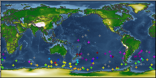 Southern Ocean Carbon and Climate Observations and Modeling (SOCCOM) BGC-Argo float data is now available on the PolarWatch ERDDAP. The SOCCOM project augments conventional Argo floats with biogeochemical sensors to measure carbon (pH), nutrients (nitrate), and oxygen. About 200 autonomous floats provide coverage over the Southern Ocean, with vertical coverage deep into the water column.
Visualizing a Decade of Change in the Arctic Sea Ice Cover AGU iPoster
 PolarWatch scientist Sinéad Farrell delivered an interactive poster on visualizing change in Arctic sea ice cover at AGU 2018. The poster highlights NOAA Lab for Satellite Altimetry sea ice data products showing variability in ice type and ice thickness over the last decade and shows some very early ICEsat-2 results.
Spring Satellite Data Workshop in Juneau
The next NOAA Ocean Satellite Data Course will be held in Juneau, Alaska, March 5-7, 2019. In this annual three-day course participants learn about ocean satellite data and how to easily obtain it. Participants gain hands on experience working with data of interest to them. The course provides scientists who are not regular users of satellite data with the tools they need to incorporate satellite data into their projects.
Preview Datasets in Polar Projection
 We've added new data previewing capability to the PolarWatch Data Catalog. All datasets can now be viewed in polar projections and quick previews of the data are available for any time stamp over the length of record.
2017 Arctic Report Card Released
The Arctic Report Card (www.arctic.noaa.gov/Report-Card/), going into its 12th year, considers a range of environmental observations throughout the Arctic, and is updated annually. As in previous years, the 2017 update highlights the changes that continue to occur in, and among, the physical and biological components of the Arctic environmental system.
Program Scientist interviewed about Warming Arctic on Today Show
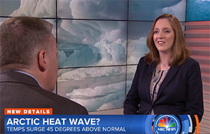 PolarWatch sea ice expert, Sinead Farrell was featured last week on a Today Show segment about warming Arctic temperatures. Watch the 3-minute video clip on the Today Show website.
New Data Catalog Interface Release
A new release of the PolarWatch data catalog provides an improved search and filter interface, data download access to all datasets in the PolarWatch catalog and critical infrastructure improvements.
New VIIRS ocean color datasets
Seven new VIIRS ocean color datasets are now available through PolarWatch. You can view them in our catalog and access them via our ERDDAP data server.
Data Catalog Prototype Released
A new interface to find, preview and download polar satellite data is now available. The interface will remain in development through 2018. Let us know if you see ways it could be improved to help you in your work.
New Data Access Example
Check out our new code example that shows how to use python to access data from the PolarWatch ERDDAP data server and make a polar projected plot.
Satellite Data Training
Register for the 2017 NOAA Ocean Satellite Data Course in Seattle, WA. It will be held Aug 22-24 and is an opportunity to learn how to incorporate satellite data into your projects and get hands on training from experts.